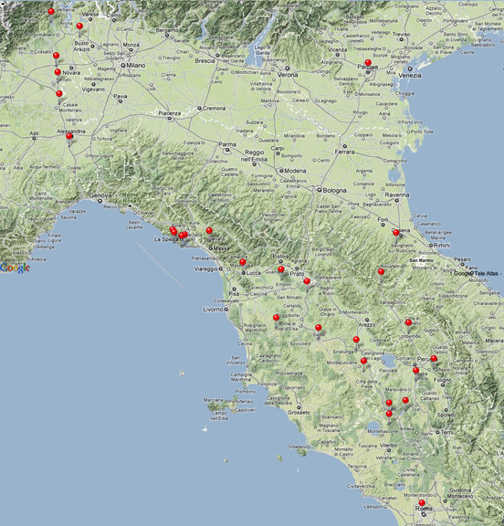
 The following posts are a digital diary of the month I spent in Italy. I generated the map in iPhoto to keep track of where I went. The points show the places in Italy where I left my Nikon Coolpix P6000 camera on long enough that it had a chance to acquire a GPS signal and record the lat/long of the pictures I was taking. There are many more points in between those shown on this map, but I could only display them if I zoomed in. Examples of zooming in are shown on the previous post This GPS data, tho' incomplete, sure helped me label my photos!
Saturday, June 18, 2011
Looking back on Italy
The following posts are a digital diary of the month I spent in Italy. I generated the map in iPhoto to keep track of where I went. The points show the places in Italy where I left my Nikon Coolpix P6000 camera on long enough that it had a chance to acquire a GPS signal and record the lat/long of the pictures I was taking. There are many more points in between those shown on this map, but I could only display them if I zoomed in. Examples of zooming in are shown on the previous post This GPS data, tho' incomplete, sure helped me label my photos!
Looking Back on Italy2


 The GPS tagging is a pretty cool feature of my point-and-shoot Nikon. Once I download the pictures to iPhoto, the place where each picture was taken shows as a pin on a map. I can zoom in on some of these points to identify the exact street or place where I was standing when I took the pic (the accuracy probably depends on the level of detail for google maps for that area - - high for cities, lower in the sticks). I've attached closeups of the photo-taking points for Assisi, Siena, Volterra, and Cinque Terre by boat as examples.
Subscribe to:
Comments (Atom)